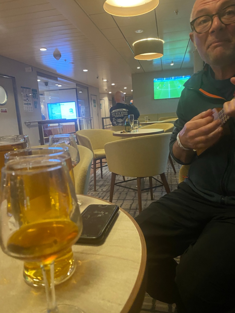
The trip from Portsmouth to Bilbao on Brittany Ferries was smooth in every respect. Good service, good food, and calm waters throughout the crossing. In the best traditions of our friendship, we are last to depart the bar on the evening of April 1st, having treated a few hardy souls to the delights of Richard’s travel ukulele and Andy’s newly acquired harmonica!
At 7am local time, we disembarked to the quiet streets of the Bilbao ferry terminal and headed to the city centre some 10 miles away. It was just a few degrees C but sunny and dry, so all started out well.
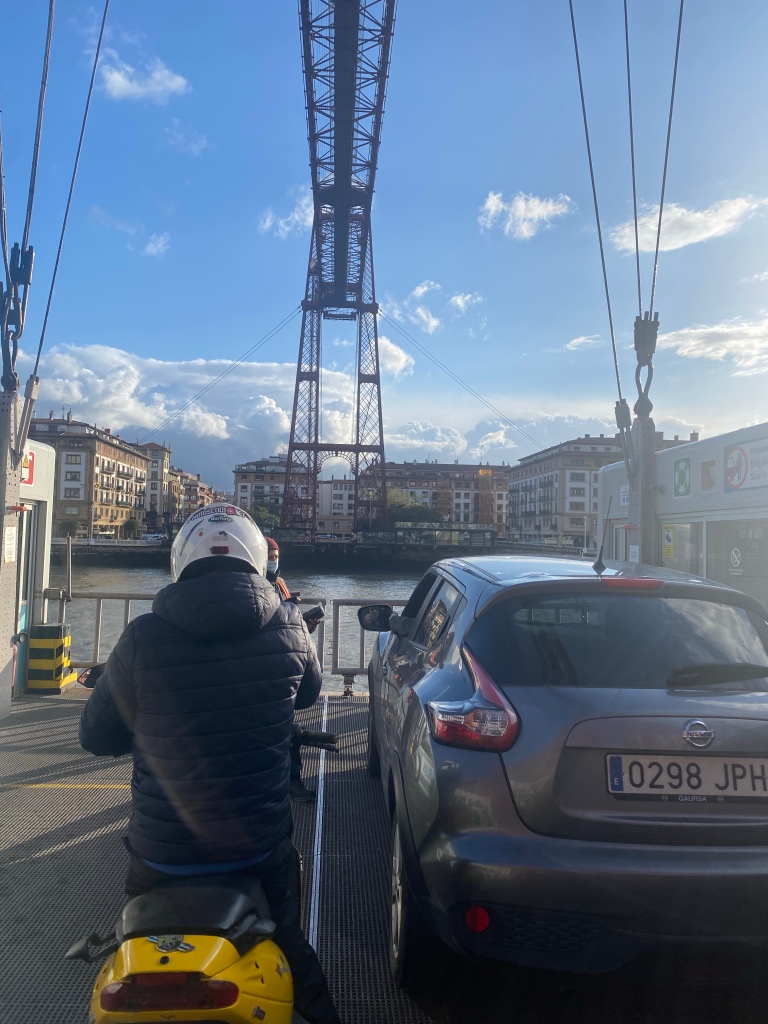
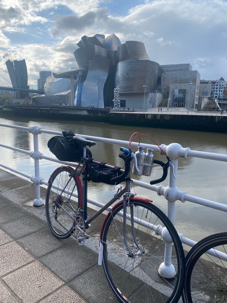
We followed the estuary until our GPS directed us to cross it on a cable platform ‘ferry’, the likes of which I’ve never seen anywhere else. We had to find a cash machine on the other side because they only accepted cash, and we weren’t carrying any! Continuing to follow the river we then stopped for a quick photo shoot across from the Guggenheim Museum on the opposite bank.
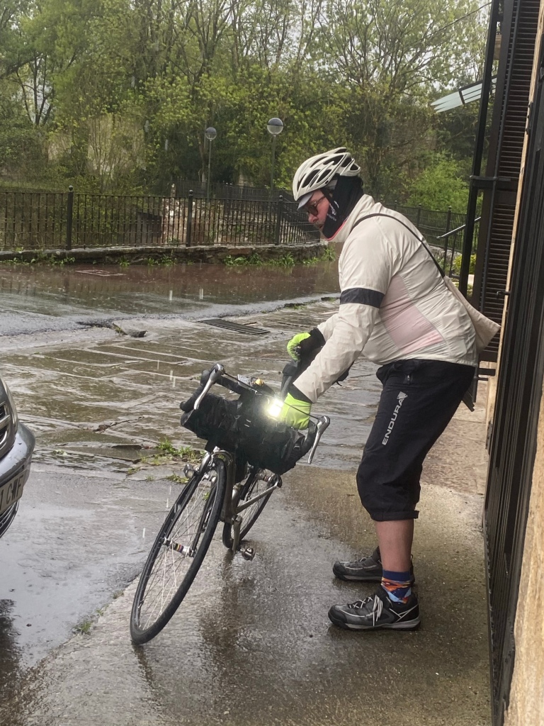
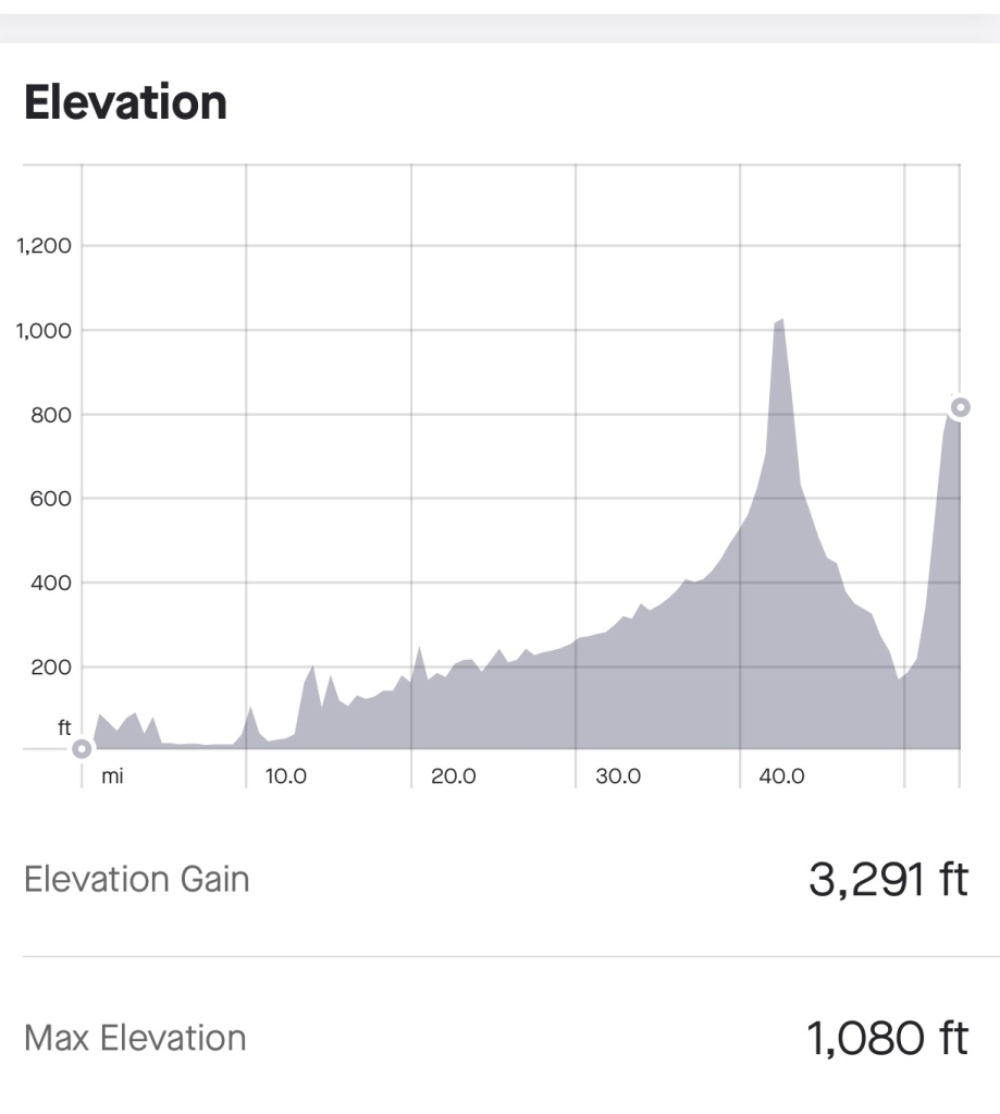
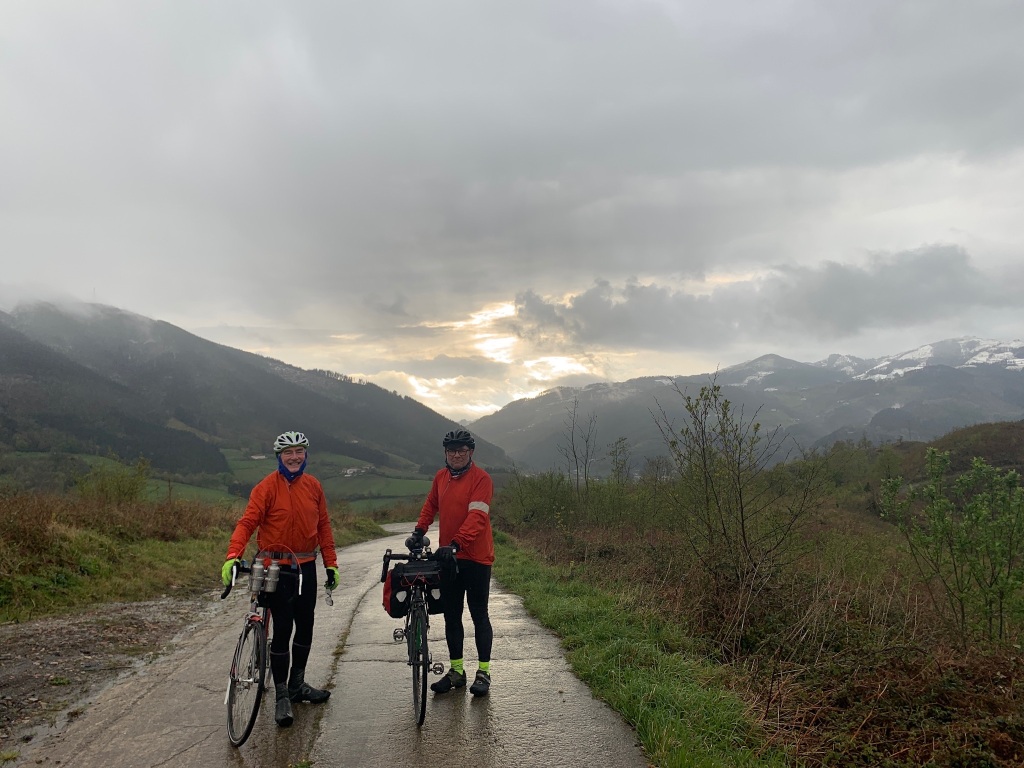
Our destination for the day was a converted farmhouse about 8km outside of Elgoibar in the foothill of the Picos mountains, a ride of about 50 miles where most of the hills would be in the later part of the ride. We could see snow on the hills to our right and it remained cold. There was a little sleet at first followed by prolonged period of rain. As far as practicable, we stopped to shelter from the rain, grabbing coffee and sustenance from various cafes along the route, but we inevitably became wet and uncomfortable. At one point. Andy took the opportunity to wash his bike off with the rain pouring off the roof of a building during one of the downpours.
The terrain became hiller in the second part of the ride and we braced ourselves for the final climb to our accommodation for the night, the Casa rural Abatetxe. We followed our GPS app, Komoot, and after a huge climb, a short descent, and another shorter climb on rough concrete roads that were too steep to cycle up safely, we were directed to ‘turn left’. The track indicated was hardly passable on foot, let alone on a loaded bike and although we knew we we’re close, we couldn’t see our destination. We had an inkling that we are on the wrong side of a valley, so we put in a call to Matteo, our host. He stepped outside to look for us and, sure enough, was able to see our bike lights in the distance. We were not far away but he said that it was a round trip of several mile to get to him – the app had led us up the wrong climb. Matteo offered to have us picked up by his wife, Annie, and we accepted gratefully. We had ridden loaded bikes 53 miles in the rain and cold and were ready for dinner.
As Annie drove us to the farmhouse, we realised just how tough a ride it would have been if we’d insisted on cycling. The road to the casa was more of the narrow, rough concrete type with gradients that appeared to be 20% in places, and the snow was falling. The forecast for the following day was for 2 degrees C, and more snow. Our destination would be San Sébastien, about 50 miles away, and with the biggest climb of our tour to start the day. As this was meant to be a leisure ride, rather than an endurance test, we decided to take the train and continue our ride the following day after exploring the eateries of San Sébastien.
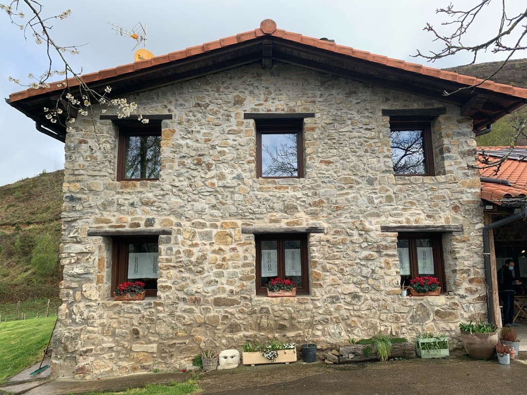
In the meantime, dinner at the casa was a simple salad, superb homemade pizzas and chocolate brownie, and some local cider to wash it all down. The casa is a beautifully restored building in a stunning setting but it was not the weather for sitting outside to admire the view. The following morning, after a good breakfast, Matteo drove us into town to catch the train. He could not have been a more considerate and helpful host.

Paper maps every time for me. Some of the GPS devices seem to make up roads as they see fit; always, always trust a proper map. A cycling friend used Komoot, it tried to send him on a fictitious bridge over the river Avon in Worcestershire…still have no understanding why it would do that. I hope your weather has improved, northern Spain is a beautiful but tough place to cycle.
LikeLike
Oh my goodness you are hardy souls! The scenery does look amazing though and worth the effort!
Good food and fine wine on the way sound wonderful, especially with the accompanying ukulele and harmonica ensemble!
Enjoy the rest of your journey! Xxxxx
LikeLike
Blimey honey, that’s quite a start! Supper sounds good though.
Stay warm and safe xxxx
LikeLike
Well Done guys, amazing territory and weather, good luck with the rest of the journey. Love Sue and Rog.
LikeLike